Went up highway 80 to 20 and Bowman Lake road. Hiked the little loop built by PG&E called the Sierra Discovery Trail. It's just short of a mile and follows a loop of the Bear River. Saw two, that's TWO rattlesnakes. The first one was by the river and Commando nearly stepped on it. The second one was very near the bridge on the "easy way" part of the trail. It was guarding its lunch squirrel and was very irritated that hikers kept passing by and interrupting it's lunch. Both snecks just wanted to be left alone and just gave us a brief rattle.
Showing posts with label Hike. Show all posts
Sunday, May 28, 2017
Monday, September 02, 2013
Finding the Forgotten Flat trail from Silver Lake
Older maps show a trail from Silver Lake down the Forgotten Flat trail to the Silver Fork of the American River. It's largely been obliterated and the forest service has blocked the road to the parking area. Someone has ducked the early parts of the trail and, once I found those, was able to stay on the trail itself.
It's an excellent trail and I'm not sure why it's been removed?
http://goo.gl/maps/cGmEo
It's an excellent trail and I'm not sure why it's been removed?
http://goo.gl/maps/cGmEo
Sunday, June 16, 2013
Hike around the marshy lake at Kyburz Flat
We've been enjoying exploring the Truckee terrain. Most of it is meadow mixed with pine forests and lots of streams. Kyburz Flat is a huge meadow and beautiful all year. I was there this year in the winter and earlier in the spring. We walked around on the other side of the meadow and took some pictures of deer bones.
There are two pictures of the marsh/meadow/lake. They are the same picture, one is a close up. Most of the "lake" is marsh grass with a few pockets of open water. Many ducks and geese are hiding in there enjoying the food and safety. Occasionally they would fly out.
These aren't good pictures, but these are what look like fairy rings. There is a small island topped with sagebrush and late spring wildflowers. There seems to be a ring of water around the island. There are several of these and they are stunning. I would like to do a flyover to get a good view of them. I suspect it would be a very muddy trip to try to wade out and see them up close.
There is also a picture of Commando just gazing around while we take a quick rest in the shade. Great day, walked for about 4K, very easy and I've been meaning to do this hike for some time.
There are two pictures of the marsh/meadow/lake. They are the same picture, one is a close up. Most of the "lake" is marsh grass with a few pockets of open water. Many ducks and geese are hiding in there enjoying the food and safety. Occasionally they would fly out.
These aren't good pictures, but these are what look like fairy rings. There is a small island topped with sagebrush and late spring wildflowers. There seems to be a ring of water around the island. There are several of these and they are stunning. I would like to do a flyover to get a good view of them. I suspect it would be a very muddy trip to try to wade out and see them up close.
There is also a picture of Commando just gazing around while we take a quick rest in the shade. Great day, walked for about 4K, very easy and I've been meaning to do this hike for some time.
Monday, September 24, 2012
Girls Gone Camping 2012
We stayed at a nice house near Heavenly. First night we cooked delicious T-bones (with balsamic vinegar reduction and bleu cheese) and some red potatoes.
On Saturday we relaxed. I took a brief trip to Kiva Beach. Too bad Commando wasn't there as he would have given it 4 paws up. There was almost no one there when I arrived around noon and snagged a prime shady space leaning against a log. I didn't swim but did wade out a good distance to admire the view. Free parking, few people, and a spectacular view!
Met everyone else at Harvey's and tried to eat at Cabo Wabo. As it was closed, we ate at the American River Cafe across the street at Harrah's. It was extremely average if not more so.
We gambled for a bit with no big winner's and then headed back to the house to drink and play games. A card game called "Spite and Malice" was a hit although I am pretty sure that Shirley was just making the rules up. We also played Scrabble and almost everyone drank. Dinner that night was delicious pasta and meat balls.
On Sunday Tami and I headed for Spooner Lake and did a leisurely hike around (2.1 miles). It's a pretty enough lake with aspens scattered around and the trail is relatively level. It might even be possible to take a wheelchair around if one could stand being tilted to one side or the other. We headed off trail to view the various animal tracks in the mud and got covered in some bugs that were feasting on the young willows. The bugs were harmless. It's a nice enough hike but not particularly wonderful. The trail was busy (and will probably be nearly mall-like in the summer). Early spring and later in the fall (when the aspens turn) would be the best times to visit.
We did end up driving an older couple from Boston to find their car. They had passed us on the last uphill bit while we were gawping at some scenery and then discovered they couldn't remember where they had parked. It was just in another parking node but it's always irritating to finish a nice hike and then have to roam around a less than scenic parking lot with sore feet.
We headed back to the house where everyone else was relaxing and probably fighting off a bit of a hangover.
We watched a bit of relaxing TV and developed a crush on a guy named Morgan who was buying some property with his wife. Dimples for the win!
I headed back to Kiva beach. No one was there and, as it was late in day, I stayed on the sandy part and swam. The water was cold but tolerable. Once I'd put my towel on I was warm heading back to the car in spite of the stiff breeze. I warmed up in the hot tub and then drove with Tami and Malene to Mont Bleu. Tami gamble while Malene and I ate some tolerable appetizers. Although we'd snacked most of the day, I was getting hungry. We returned to gamble and lost our usual casino contribution.
Tami and Malene did a bit more gambling at Harvey's while I rested in the car and listened to some coyotes howling off in the distance. Apparently they've added some special chairs to the slots so they move around with the game action. It sounded fun!
Sunday was get away day. We divided up the food and the little remaining booze, cleaned up the place, and left for another year. Next year may be the coast although I would be happy to return to Lake Tahoe every year.
On Saturday we relaxed. I took a brief trip to Kiva Beach. Too bad Commando wasn't there as he would have given it 4 paws up. There was almost no one there when I arrived around noon and snagged a prime shady space leaning against a log. I didn't swim but did wade out a good distance to admire the view. Free parking, few people, and a spectacular view!
Met everyone else at Harvey's and tried to eat at Cabo Wabo. As it was closed, we ate at the American River Cafe across the street at Harrah's. It was extremely average if not more so.
We gambled for a bit with no big winner's and then headed back to the house to drink and play games. A card game called "Spite and Malice" was a hit although I am pretty sure that Shirley was just making the rules up. We also played Scrabble and almost everyone drank. Dinner that night was delicious pasta and meat balls.
On Sunday Tami and I headed for Spooner Lake and did a leisurely hike around (2.1 miles). It's a pretty enough lake with aspens scattered around and the trail is relatively level. It might even be possible to take a wheelchair around if one could stand being tilted to one side or the other. We headed off trail to view the various animal tracks in the mud and got covered in some bugs that were feasting on the young willows. The bugs were harmless. It's a nice enough hike but not particularly wonderful. The trail was busy (and will probably be nearly mall-like in the summer). Early spring and later in the fall (when the aspens turn) would be the best times to visit.
We did end up driving an older couple from Boston to find their car. They had passed us on the last uphill bit while we were gawping at some scenery and then discovered they couldn't remember where they had parked. It was just in another parking node but it's always irritating to finish a nice hike and then have to roam around a less than scenic parking lot with sore feet.
We headed back to the house where everyone else was relaxing and probably fighting off a bit of a hangover.
We watched a bit of relaxing TV and developed a crush on a guy named Morgan who was buying some property with his wife. Dimples for the win!
I headed back to Kiva beach. No one was there and, as it was late in day, I stayed on the sandy part and swam. The water was cold but tolerable. Once I'd put my towel on I was warm heading back to the car in spite of the stiff breeze. I warmed up in the hot tub and then drove with Tami and Malene to Mont Bleu. Tami gamble while Malene and I ate some tolerable appetizers. Although we'd snacked most of the day, I was getting hungry. We returned to gamble and lost our usual casino contribution.
Tami and Malene did a bit more gambling at Harvey's while I rested in the car and listened to some coyotes howling off in the distance. Apparently they've added some special chairs to the slots so they move around with the game action. It sounded fun!
Sunday was get away day. We divided up the food and the little remaining booze, cleaned up the place, and left for another year. Next year may be the coast although I would be happy to return to Lake Tahoe every year.
Sunday, September 09, 2012
Ambled up Silver Creek on some use trails and then just bushwhacking.
Met some dogs with a friendly owner. The bushwhacking was starting to
be quite a bit too bushy so we crossed over the creek and then headed to
the road. We got back just above the giant log that blocks traffic.
It's not a bad area in any season, even this dry one. Unlike early
spring, there weren't too many mosquitoes
Saw some fresh deer tracks so they'd better start hiding as I believe hunting season is soon.
View Northern California Hike, Bike, Snowshoe, and Dog Walk Adventures in a larger map
Saw some fresh deer tracks so they'd better start hiding as I believe hunting season is soon.
View Northern California Hike, Bike, Snowshoe, and Dog Walk Adventures in a larger map
Sunday, September 02, 2012
Bye-bye faithful old hiking boots
We've done plenty of miles together but it's time to say goodbye. We've been on dry trails and on wet trails and often on no trail at all. You've kept my feet warm and comfortable with no blisters. The foot doctor said that you had too many holes and too much water was pouring in. You couldn't be saved. Here's your last view over Caples Lake and Schneider Cow Camp road. Your laces have been removed and their memory will live on in my new boots. Happy trails and may you biodegrade with dignity in the Sacramento solid waste landfill.
Saturday, July 28, 2012
Stroll near Upper Lola Montez Lake
Had both Harry and Commando on this trip. I do have some adorable pictures of them swimming and standing and may soon be able to link them here.
View Northern California Hike, Bike, Snowshoe, and Dog Walk Adventures in a larger map
Sunday, September 11, 2011
Bloodsucker Lake
BL itself is not incredibly scenic but the views of Pyramid Peak are interesting.
We started by following the instructions of Ted's Outdoor World. Take highway 50 east from Sacramento. After Kyburz, turn left on Wrights Lake road. About a mile after the Lyon's Creek bridge, turn right onto forest service route 11N28. If you get to the big meadow, or to the Wrights Lake tie road to Icehouse reservoir, you've gone too far. The road is very good for about 1.3 miles. Then it starts to get bad. A higher clearance vehicle is probably best. The section pictured at left is an uphill section where it starts to get bad.At just about 2 miles, turn left onto FS 11N28B. This will head uphill and will get progressively worse. Still, the original road looks even rougher so it's not hard to miss.
Park where the road ends in a burned over space that was probably used for logging. Just up the hill is a nice turnout for what is called distributed camping. Someone has already built a rock campfire ring and there are views.
You'll be traveling off trail for about a half mile to a mile so have a good map or GPS and some route finding skills. The area is fairly open from logging and there are plenty of use trails. You'll travel slightly uphill, then downhill to BL and generally veer left when you have a chance.
We spent some time wandering around finding the route but were never really lost.
Head uphill from where you parked heading straight up from the end of a stack of logs.
This tree stump growing out of a rock is a nice first goal just a few steps up the hill. Stay below this tree and head to the left.
It's not very brushy here so by staying on the forest duff and heading on the easiest path we soon found the first use trail. Turn left on it to see a cute little No Name pond.
Here is the No Name pond. Folks have camped here and at the end just to the left. We ended up hiking around the pond and finding another and better marked use trail but it wasn't necessary. It's perfectly easy to get to BL by leaving this pond and heading right.Our hiking day was under overcast skies with thunder and lightning. There were some sprinkles on the hike and we saw this hail on the ground but the really bad weather held off until we were in the car headed home.
It's always good to have Ma Nature wash the dust off the car.
By following the use trail away from No Name pond or to the right once found, you'll cross a marshy area and the use trail heads over a saddle and starts to head down, presumably to Lyon's Creek. Just after the marshy area head uphill to the left. About a football field up you'll come to another use trail that goes up the hill. Follow this and now you're good to go. There's a trail headed in the same direction as the saddle trail that crosses the uphill trail. You can get back to the No Name lake on this trail. This all sounds a bit confusing, but once you see the map and the terrain it will make sense.This from the uphill trail near the top. There is Pyramid Peak showing that you're going in the right direction. There seemed to be some faint signs of horses along the way so this may be a pack trail.
Just over the crest of the hill you'll see another big, bare logging area. You'll see double tracks from an old logging or skid road and then you just follow it for a very short mile to BL.I didn't take a picture, but there seems to be an old hunting blind built up in the tree behind the bushes. There is also another pond just downhill to the right. You'll see the reeds and grasses around it as you look through the trees on the downhill side of the road.
Here is the old road that you'll follow. It goes up for just a bit, and then heads down to BL. Just over this crest, you'll get a cell phone signal again just in case you want to call someone from the trail.The road will curve back to the left and then you'll be very close.
This is the first view of BL with Pyramid Peak in the background and reflected in the water. On a sunny day it might be more spectacular, but even on this stormy day it was scenic enough for me. Some mother ducks were swimming around in the lake too.
At the other end of the lake I think this is Blue Mountain and perhaps Mt. Agassiz in the back. I could be wrong. I sat on a rock here and ate some nuts and drank some water until the mosquitoes decided that DEET was a sauce and not something to be avoided and we headed back.Map coordinates
Monday, September 05, 2011
Silver Fork of the American River Hike
Commando and I hiked along the Silver Fork of the American River and stopped here for a long session of reading, napping, eating lunch, chasing rodents, messing around in the water, and playing splash. There's a heavily used trail along the river. About a quarter mile upstream is a small waterfall and above that some granite pools. There were tons of people in those pools and all over the surrounding rocks. I was hoping this trip wasn't going to be a bust. We left the river and headed down a wash just over a big granite ridge. It lead onto some more granite and then into the little forested area. Downstream and over another granite ridge was another small waterfall and someone's tent. We were at the river for about 2 hours and just after a splash session we were passed by two guys hopefully fishing the river. We hiked back up by just following the various granite outcroppings and then meandered (pushed through somewhat dense forest with lots of downed stuff) back to the trail.
I'll go back again in the spring, and maybe for a snowshoe trip this winter.
Saturday, August 13, 2011
Not to the Enchanted Pools
Drove up to Wrights Lake and hiked some of the Rockbound trail. I was planning on going to the E.P. but decided at the trail junction to stay on the R.T. It's a nice trail, at least as far as I took it, although I prefer a less sandy surface.
Commando had a great time swimming in Beauty Lake and sniffing things. We met an unfriendly dog and a friendly dog and several overnight hikers.
It's finally drying out although there is still snow on the peaks. Grassy areas in the sun are dry and brown. Grassy areas in more shaded areas (or slightly higher) are still green and filled with wildflowers. I met a couple coming up having just passed through the most beautiful scenic meadow. He was ranting on about statistical analysis and missing the whole point.
Commando had a great time swimming in Beauty Lake and sniffing things. We met an unfriendly dog and a friendly dog and several overnight hikers.
It's finally drying out although there is still snow on the peaks. Grassy areas in the sun are dry and brown. Grassy areas in more shaded areas (or slightly higher) are still green and filled with wildflowers. I met a couple coming up having just passed through the most beautiful scenic meadow. He was ranting on about statistical analysis and missing the whole point.
Thursday, August 04, 2011
Blue lakes to granite lake
A few pictures from my not so successful hike to Granite lake. The snow berms were still at least 8 feet tall in places. The place is beautiful though and not too many people. At one of the closed campgrounds some attractive men were playing frisbee golf. I was hoping they would be stunned by my beauty, but alas, they weren't.I told them they didn't look drunk enough to be playing frisbee golf. One guy said he was hammered and we all laughed. Brought back memories!
Highland lakes camping August 2011
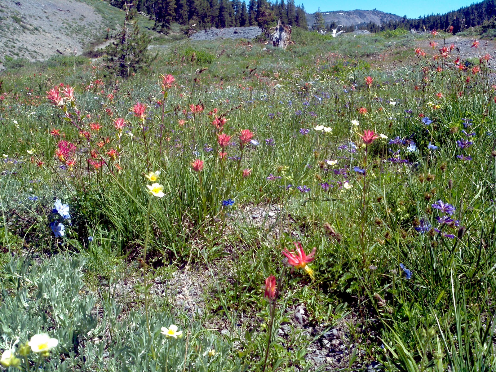
Just camped for one day somewhere along the Mokelumne River near Highland Lakes. It is a beautiful area and I will be back. The snow has not finished melting and the mosquitos are in heaven. Wildflowers are still blooming. Maybe if I can get a shuttle driver I can hike from H.L. down to Spicer Meadows reservoir before winter.If you see the picture full screen, try to count the different kinds of flowers growing on the volcanic soil. On either side are two old, inactive volcanoes.
There are a few more pictures on Picasa although they do not do the area any justice.
Tuesday, June 28, 2011
Wright's Lake June 28, 2011
Managed to drive up to within 2 miles of the lake. Took the bike uphill for about a mile, then stashed it in the woods and proceeded on foot. There was too much snow on the road to make the bike feasible. Hiked over snow berm after snow berm until I got to the boat ramp at the lake. It's completely submerged. The view is spectacular as you can see.
I think that's Mt. Price at the right. I've hiked up its shoulders to Grouse Lake and also to the cirque in the middle of the picture to Twin Lakes. I never get tired of this view and this area.
This is some of the snow we had to cross to get to the boat ramp. It was very firm and packed except at the edges and was not a problem to traverse. There was a vehicle just past this berm. He said it had taken him a half an hour to get through. I was very glad I'd oiled my boots to keep the water out because what wasn't snow was water furiously trying to get downhill right now!
I was also glad to find my bike where I had left it behind some small pinelings. It was well hidden and I walked around its vicinity before I finally spotted it.
I think that's Mt. Price at the right. I've hiked up its shoulders to Grouse Lake and also to the cirque in the middle of the picture to Twin Lakes. I never get tired of this view and this area.
This is some of the snow we had to cross to get to the boat ramp. It was very firm and packed except at the edges and was not a problem to traverse. There was a vehicle just past this berm. He said it had taken him a half an hour to get through. I was very glad I'd oiled my boots to keep the water out because what wasn't snow was water furiously trying to get downhill right now!I was also glad to find my bike where I had left it behind some small pinelings. It was well hidden and I walked around its vicinity before I finally spotted it.
Monday, June 20, 2011
Camping in Sierra County CA in June 2011
Took a quick trip up to Sierra County for a camping trip. I had wanted to stay for free somewhere along the Gold Lakes highway but there was still too much snow. We ended up at the Bear Valley campground and it was lovely. There are plenty of places to hike and we had the campsite to ourselves for one night. Highlights: Bristlecone pine, Weird flower, Little Last Chance Scenic canyon, the Little Truckee river, and Commando deciding to cover himself with mud from a seep just before bed.Click the picture to go to my Picasa album and see more pictures.
Sunday, December 19, 2010
Wet weather walks
On Saturday we drove up to the Spenceville Wildlife Refuge and hiked around at random. We scrambled through a barbed wire fence, getting my knees and lower legs thoroughly wet. We hiked along an old dirt road and then went along a well used cow path that went uphill. It stopped being a path as we neared the top of the hill which was crowned with a fortress of upthrust volcanic rock. We amused ourselves scrambling on the rock and then followed a fence line downhill to another old dirt road. This followed an old water channel back to the car. I scraped my knee a bit on the barbed wire getting back out so I hope my tetanus shots are up to date.
Today we drove up to see Hidden Falls just outside of Auburn. It's a pleasant enough walk through the typical foothills poison oak, regular oak, scrub pine and brushy tick habitat. Commando couldn't be off leash the whole time. There was some sort of Placer County employee there (possibly a ranger), and then there was an open range (saw no cattle), and then there was another not too friendly dog. He did manage to be off leash for about 1/2 the time though and enjoyed the usual sniffing, digging, and hopeful chasing of imaginary animals.
I had thought about going to the snow in spite of the storm but decided I just wasn't ready to freeze and have no view. The snowshoes still wait in my car for suitable weather.
Today we drove up to see Hidden Falls just outside of Auburn. It's a pleasant enough walk through the typical foothills poison oak, regular oak, scrub pine and brushy tick habitat. Commando couldn't be off leash the whole time. There was some sort of Placer County employee there (possibly a ranger), and then there was an open range (saw no cattle), and then there was another not too friendly dog. He did manage to be off leash for about 1/2 the time though and enjoyed the usual sniffing, digging, and hopeful chasing of imaginary animals.
I had thought about going to the snow in spite of the storm but decided I just wasn't ready to freeze and have no view. The snowshoes still wait in my car for suitable weather.
Sunday, November 14, 2010
Gambling and hiking along the Mormon Emigrant Trail
Met up with some of the BOE folks for a bit of gambling and the delicious buffet at Red Hawk. Commando napped in his luxurious palace in the back of the car. I was a loser at all the games I played. Scott was the big winner.
Then drove up MET to see if it was clear to Highway 88. I turned close to the end as the snow was noticeably deeper and I really do NOT want to get stuck. We hiked along the Light Canyon road in light snow, or maybe it wasn't Light Canyon. We strolled for about a mile paying close attention to the interesting animal footprints. We got to a road crossing that hadn't been driven too since the snow dropped. There was a rock fire pit and a nice place to camp or picnic. I briefly considered going overland on the unmarked road, but decided that it would be wiser to just retrace my steps.
I tried several times to take a good picture of the Crystal range. It was glowing with the late afternoon sun. Unfortunately, in my cell phone pic, it was a tiny whitish smudge. Someone else with a better camera will need to snap the picture.
Then drove up MET to see if it was clear to Highway 88. I turned close to the end as the snow was noticeably deeper and I really do NOT want to get stuck. We hiked along the Light Canyon road in light snow, or maybe it wasn't Light Canyon. We strolled for about a mile paying close attention to the interesting animal footprints. We got to a road crossing that hadn't been driven too since the snow dropped. There was a rock fire pit and a nice place to camp or picnic. I briefly considered going overland on the unmarked road, but decided that it would be wiser to just retrace my steps.
I tried several times to take a good picture of the Crystal range. It was glowing with the late afternoon sun. Unfortunately, in my cell phone pic, it was a tiny whitish smudge. Someone else with a better camera will need to snap the picture.
Thursday, November 11, 2010
Sitting at Icehouse Lake in the Eldorado National Forest
I wasn't in a very good mood today but forced myself to head up and do some hiking. I'd originally planned to hike around Wright's Lake, but there was a bit too much snow on the road. The vehicle has 4WD and snow tires, but they don't seem to be really good snow tires. We drove back down to 50 and then up to Icehouse. We parked along the Wright's Lake Tie road and hiked down to the lake and then along the shore. I tossed sticks for Commando and found one that he really liked. He carried it for a long time.I stopped in some shade to lean against a rock and just look out over the lake. I like this picture because I think I framed it nicely.
Sunday, November 07, 2010
First snow (for me) winter 2010
Drove up to Wright's Lake again. Just before the Lyon's Creek trailhead it was starting to rain and snow at the same time. After Lyon's Creek it was snowing and with every little bit of elevation the snow got deeper and deeper. We parked at the main lot for the Bloodsucker lake trail and hiked through the campground and along the trail. We could have crossed the creek if we'd wanted to wade through the calf high, freezing water but we wisely chose not to. Instead we followed a clearly delineated trail. It's not marked on the map, nor is it evident on Google Earth. The route started to get quite marshy and so we headed back.
Commando really LOVES the snow and he ran everywhere. I hope this snow is a harbinger of a great snow shoeing season.
Monday, November 01, 2010
Low elevation hikes
It rained on Saturday so drove up to Colfax and took the Yankee Jim's road up to Foresthill. We tried to hike up the American River at the bridge crossing but found that Shirttail Creek was a bit treacherous to cross without a human partner to report on any broken limbs. We ended up hiking around the forest near Foresthill road and the Christmas tree place. Commando chased a deer.
On Sunday it was nice an sunny. We drove up to Colfax and then up Iowa Hill road to the Foresthill area. The river crossing was busy with folks so we didn't stop there. The hoary denizens of Iowa Hill were out in full force and stared at our unusual car when we drove by. We ended up hiking in the forest and on some OHV trails and then at the Fork House trail and also on the forest service road near Fork House.
I put two pads in the heel of my problem foot and it feels fine. Maybe I just need to make absolutely sure that it's fully elevated and I'll be healed.
Go Giants!
On Sunday it was nice an sunny. We drove up to Colfax and then up Iowa Hill road to the Foresthill area. The river crossing was busy with folks so we didn't stop there. The hoary denizens of Iowa Hill were out in full force and stared at our unusual car when we drove by. We ended up hiking in the forest and on some OHV trails and then at the Fork House trail and also on the forest service road near Fork House.
I put two pads in the heel of my problem foot and it feels fine. Maybe I just need to make absolutely sure that it's fully elevated and I'll be healed.
Go Giants!
Sunday, October 17, 2010
Grouse Lake Success
On my second try I made it to Grouse Lake. The first time I just wasn't feeling very good and even the easy, flat trail sections were hard. This time, although the steep climb was hard, we charged right up. Once the trail splits from the Twin Lakes trail there is a short, somewhat steep granite section. Then, there's a right turn up and there's a steeper forest section. Next, it levels off a bit, but still angling up and somewhat southeast. Just before the last bit, we ran into some hikers on the way down. The man said the lake was just at the base of the leftmost rounded "peak" as I faced the steep forest/granite wall ahead. The trail switches back to the left (northish?) and angles up the wall. This section is the steepest and reminded me of the trail to Loch Leven lakes or even Mt. Judah. There weren't many switchbacks though because there isn't really room for them.
We started to cross the stream that exits the lake but I couldn't see the trail on the other side. As it turns out, that's the trail. Instead we took some marked cairn "trails" up and did eventually reach the lake. We found a likely spot. Commando gobbled his trail meal down. I had my banana and some vitamin water placebo. I soaked my feet in the lake. Wow. It was cold. It was so cold my feet turned red and my toes started to ache with cold. The socks and boots went back on.
As we headed back we ran into a backpacker and his dog coming up over the granite ridge instead of from the trail. The backpacker asked what lake this was, and then asked how to get to Twin Lakes. Hmmm. I told him the general vicinity to head cross-country and said he could also backtrack on the trail. I hope he makes it.
I then stupidly decided to try and make it back cross-country. We angled along the ridge generally heading down, west, and south trying to find the path of least resistance. My theory was that there was a long, gradual ridge that led back to Wright's Lake. I don't think my theory was correct. If it was correct, I never found the ridge.
We headed down dry stream beds interspersed with granite slabs or large granite blocks. As we got lower, we got caught in a section of large granite blocks (some the size of houses) and dense manzanita. We had to climb rocks and push through dense flora. At one point I looked down and realized that the manzanita was hiding a 3-4 foot drop next to the boulder I was trying to go around. Commando had difficulty too. He can't see over the manzanita and he's not so agile over the big rocks. He needs some type of flat surface for his paws to grip.
At one point I realized that, although we'd been hiking for a while and were still descending, we weren't on the trail yet and the sun was starting to set. We headed straight down to get to the trail fastest. At first, we were helped by some deer trails. There were also fewer rocks. Then, it was back to thick manzanita. We just pushed through as carefully and as quickly as possible. At last we reached some flat space and soon discovered the trail, just inside the Desolation Wilderness boundary. I'm really not sure my "short cut" had saved us any distance.
The sun set before we got back, but we were almost to the flat section of the trail when it set. There was plenty of residual light to see. The moon was up and a little over half full so it's reflected light was enough to cast a faint shadow.
Both of us were exhausted when we got back to the car after about 7 hours of hiking. Commando is still sleeping on the bed, a sure sign that he's one tired doggy.
It was a great hike though!
We started to cross the stream that exits the lake but I couldn't see the trail on the other side. As it turns out, that's the trail. Instead we took some marked cairn "trails" up and did eventually reach the lake. We found a likely spot. Commando gobbled his trail meal down. I had my banana and some vitamin water placebo. I soaked my feet in the lake. Wow. It was cold. It was so cold my feet turned red and my toes started to ache with cold. The socks and boots went back on.As we headed back we ran into a backpacker and his dog coming up over the granite ridge instead of from the trail. The backpacker asked what lake this was, and then asked how to get to Twin Lakes. Hmmm. I told him the general vicinity to head cross-country and said he could also backtrack on the trail. I hope he makes it.
I then stupidly decided to try and make it back cross-country. We angled along the ridge generally heading down, west, and south trying to find the path of least resistance. My theory was that there was a long, gradual ridge that led back to Wright's Lake. I don't think my theory was correct. If it was correct, I never found the ridge.
We headed down dry stream beds interspersed with granite slabs or large granite blocks. As we got lower, we got caught in a section of large granite blocks (some the size of houses) and dense manzanita. We had to climb rocks and push through dense flora. At one point I looked down and realized that the manzanita was hiding a 3-4 foot drop next to the boulder I was trying to go around. Commando had difficulty too. He can't see over the manzanita and he's not so agile over the big rocks. He needs some type of flat surface for his paws to grip.
At one point I realized that, although we'd been hiking for a while and were still descending, we weren't on the trail yet and the sun was starting to set. We headed straight down to get to the trail fastest. At first, we were helped by some deer trails. There were also fewer rocks. Then, it was back to thick manzanita. We just pushed through as carefully and as quickly as possible. At last we reached some flat space and soon discovered the trail, just inside the Desolation Wilderness boundary. I'm really not sure my "short cut" had saved us any distance.
The sun set before we got back, but we were almost to the flat section of the trail when it set. There was plenty of residual light to see. The moon was up and a little over half full so it's reflected light was enough to cast a faint shadow.
Both of us were exhausted when we got back to the car after about 7 hours of hiking. Commando is still sleeping on the bed, a sure sign that he's one tired doggy.
It was a great hike though!
Subscribe to:
Posts (Atom)


