Sunday, September 11, 2011

Bloodsucker Lake

This is an unusual route to Bloodsucker Lake in the Eldorado National Forest that involves a bit of cross-country travel but is still easy. I believe it shortens the distance to the lake. There are also no creek or stream crossings. My Atrix GPS said 4 miles but I think it was closer to 2 miles. The elevation is at about 7200 feet and there isn't much elevation gain or loss.

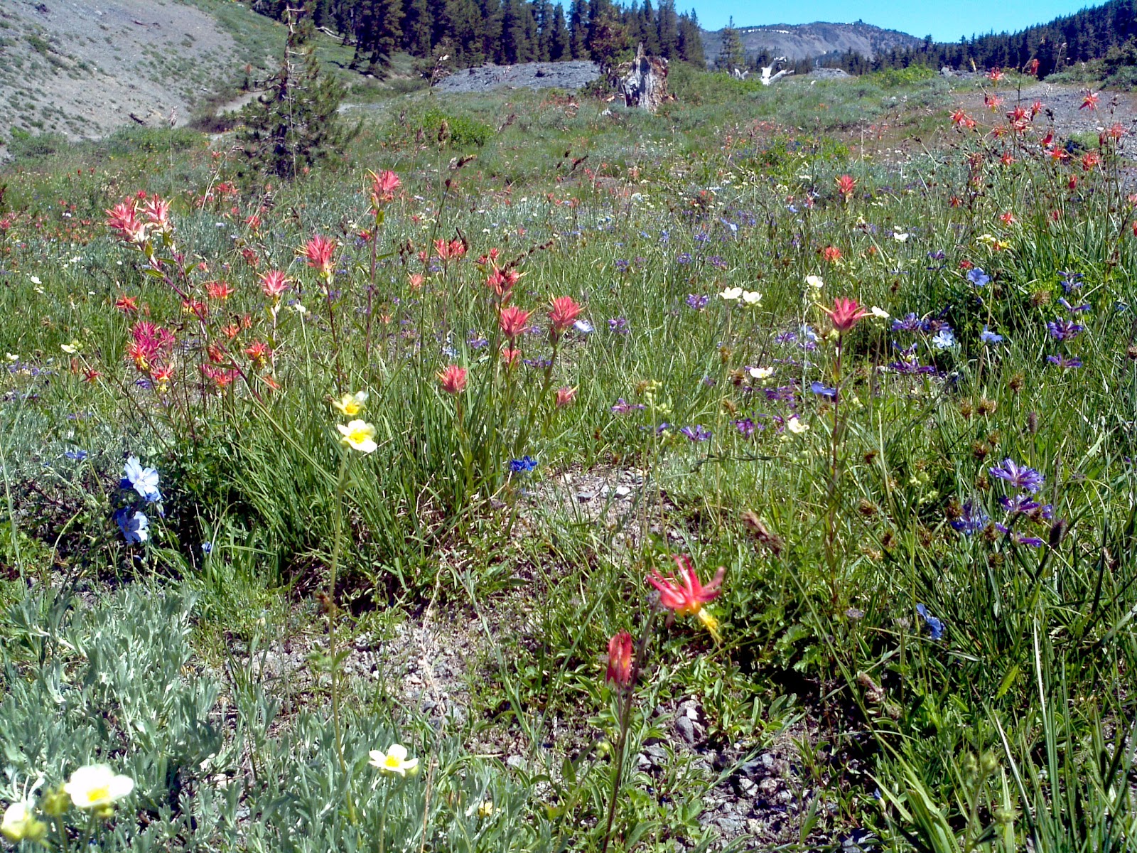
BL itself is not incredibly scenic but the views of Pyramid Peak are interesting.

We started by following the instructions of Ted's Outdoor World. Take highway 50 east from Sacramento. After Kyburz, turn left on Wrights Lake road. About a mile after the Lyon's Creek bridge, turn right onto forest service route 11N28. If you get to the big meadow, or to the Wrights Lake tie road to Icehouse reservoir, you've gone too far. The road is very good for about 1.3 miles. Then it starts to get bad. A higher clearance vehicle is probably best. The section pictured at left is an uphill section where it starts to get bad.


At just about 2 miles, turn left onto FS 11N28B. This will head uphill and will get progressively worse. Still, the original road looks even rougher so it's not hard to miss.


Park where the road ends in a burned over space that was probably used for logging. Just up the hill is a nice turnout for what is called distributed camping. Someone has already built a rock campfire ring and there are views.


You'll be traveling off trail for about a half mile to a mile so have a good map or GPS and some route finding skills. The area is fairly open from logging and there are plenty of use trails. You'll travel slightly uphill, then downhill to BL and generally veer left when you have a chance.

We spent some time wandering around finding the route but were never really lost.

Head uphill from where you parked heading straight up from the end of a stack of logs.


This tree stump growing out of a rock is a nice first goal just a few steps up the hill. Stay below this tree and head to the left.


It's not very brushy here so by staying on the forest duff and heading on the easiest path we soon found the first use trail. Turn left on it to see a cute little No Name pond.


Here is the No Name pond. Folks have camped here and at the end just to the left. We ended up hiking around the pond and finding another and better marked use trail but it wasn't necessary. It's perfectly easy to get to BL by leaving this pond and heading right.
Our hiking day was under overcast skies with thunder and lightning. There were some sprinkles on the hike and we saw this hail on the ground but the really bad weather held off until we were in the car headed home.

It's always good to have Ma Nature wash the dust off the car.


By following the use trail away from No Name pond or to the right once found, you'll cross a marshy area and the use trail heads over a saddle and starts to head down, presumably to Lyon's Creek. Just after the marshy area head uphill to the left. About a football field up you'll come to another use trail that goes up the hill. Follow this and now you're good to go. There's a trail headed in the same direction as the saddle trail that crosses the uphill trail. You can get back to the No Name lake on this trail. This all sounds a bit confusing, but once you see the map and the terrain it will make sense.

This from the uphill trail near the top. There is Pyramid Peak showing that you're going in the right direction. There seemed to be some faint signs of horses along the way so this may be a pack trail.


Just over the crest of the hill you'll see another big, bare logging area. You'll see double tracks from an old logging or skid road and then you just follow it for a very short mile to BL.

I didn't take a picture, but there seems to be an old hunting blind built up in the tree behind the bushes. There is also another pond just downhill to the right. You'll see the reeds and grasses around it as you look through the trees on the downhill side of the road.


Here is the old road that you'll follow. It goes up for just a bit, and then heads down to BL. Just over this crest, you'll get a cell phone signal again just in case you want to call someone from the trail.

The road will curve back to the left and then you'll be very close.


This is the first view of BL with Pyramid Peak in the background and reflected in the water. On a sunny day it might be more spectacular, but even on this stormy day it was scenic enough for me. Some mother ducks were swimming around in the lake too.


At the other end of the lake I think this is Blue Mountain and perhaps Mt. Agassiz in the back. I could be wrong. I sat on a rock here and ate some nuts and drank some water until the mosquitoes decided that DEET was a sauce and not something to be avoided and we headed back.


Map coordinates

Monday, September 05, 2011

Silver Fork of the American River Hike

Commando and I hiked along the Silver Fork of the American River and stopped here for a long session of reading, napping, eating lunch, chasing rodents, messing around in the water, and playing splash. There's a heavily used trail along the river. About a quarter mile upstream is a small waterfall and above that some granite pools. There were tons of people in those pools and all over the surrounding rocks. I was hoping this trip wasn't going to be a bust. We left the river and headed down a wash just over a big granite ridge. It lead onto some more granite and then into the little forested area. Downstream and over another granite ridge was another small waterfall and someone's tent. We were at the river for about 2 hours and just after a splash session we were passed by two guys hopefully fishing the river. We hiked back up by just following the various granite outcroppings and then meandered (pushed through somewhat dense forest with lots of downed stuff) back to the trail.

I'll go back again in the spring, and maybe for a snowshoe trip this winter.

Tuesday, August 30, 2011

Weird thistle pictures

Was walking with Commando outside of Davis on just a random walk and started taking some pictures of the weeds. For some reason, I just really like these pictures. I have no idea how the white one got that way


Saturday, August 13, 2011

Not to the Enchanted Pools

Drove up to Wrights Lake and hiked some of the Rockbound trail. I was planning on going to the E.P. but decided at the trail junction to stay on the R.T. It's a nice trail, at least as far as I took it, although I prefer a less sandy surface.

Commando had a great time swimming in Beauty Lake and sniffing things. We met an unfriendly dog and a friendly dog and several overnight hikers.

It's finally drying out although there is still snow on the peaks. Grassy areas in the sun are dry and brown. Grassy areas in more shaded areas (or slightly higher) are still green and filled with wildflowers. I met a couple coming up having just passed through the most beautiful scenic meadow. He was ranting on about statistical analysis and missing the whole point.

Wednesday, August 10, 2011

Trip to Bodega Bay August 2011

On Friday we all arrived at the house on Swan Way. It's a great house and we would definitely "camp" here again. Friday night was the usual drinking and staying up late laughing and talking. Saturday we went to the Sonoma County fair and the races there. It was nice to be at a quiet fair. No long lines for food and the crowds weren't enormous. The turkey races were fun.

Sunday we walked around and visited the Bodega Bay headlands. There may also have been some kite shopping.

Monday we packed up and left. Met Donna and Tami at the Rock Creek casino and lost a few dollars before heading home. Click the picture to see the rest of them.

Thursday, August 04, 2011

Something smells good

Harry and Commando going their separate ways

Yolo causeway


This was a walk with Commando and his pal Harry in the Yolo Causeway. We only picked up a few ticks.

Blue lakes to granite lake

A few pictures from my not so successful hike to Granite lake. The snow berms were still at least 8 feet tall in places. The place is beautiful though and not too many people. At one of the closed campgrounds some attractive men were playing frisbee golf. I was hoping they would be stunned by my beauty, but alas, they weren't.

I told them they didn't look drunk enough to be playing frisbee golf. One guy said he was hammered and we all laughed. Brought back memories!

Highland lakes camping August 2011

Just camped for one day somewhere along the Mokelumne River near Highland Lakes. It is a beautiful area and I will be back. The snow has not finished melting and the mosquitos are in heaven. Wildflowers are still blooming. Maybe if I can get a shuttle driver I can hike from H.L. down to Spicer Meadows reservoir before winter.

If you see the picture full screen, try to count the different kinds of flowers growing on the volcanic soil. On either side are two old, inactive volcanoes.

There are a few more pictures on Picasa although they do not do the area any justice.

Monday, July 11, 2011

Sonoma weekend

Had an excellent weekend with Andy and Ira at Villa Pia. Arrived early on Saturday and chatted with Ira while Andy was on a 25 mile bike ride with some friends. Margaret and Winnie the dog came. Commando and Winnie became great pals and played chase and wrestle and sniff stuff. I was careful to do no work the entire weekend unless lazing on the couch, taking pictures, and eating count as work.

Commando did disgrace himself a bit by separating some of the pool skimmer parts and scattering them about. Fortunately I was able to stick them back together so no pool skimmers were permanently harmed.


This is Andy removing some scummy algae from the magic pond.


This is Winnie and Commando enjoying a relaxing nap after a good game of chase.

Tuesday, July 05, 2011

What is this flower?


Don't know what this flower is. It faces to the ground and I'm propping it up with a stick. It's about the size of a half dollar. The plant is growing right in the middle of a dirt road.The plant is low growing and is maybe the size of a dinner plate. Any ideas?

Sunday, July 03, 2011

Wright's:Lake July 2011


There's sure been a change since last week. Much of the snow has melted, although it still isn't possible to drive to the lake. Hiked down to Silver Creek and then back up to the road on some old, discontinued forest service or logging road and then back up to what looks like a horse trail.

Then we drove for snacks and some time to read and sit in a chair at the big meadow at the crossroads. Lady bugs were flocking everywhere and flying around like tiny orange lights in the sun.

The picture is a big hunk of the stream bank that has fallen into the stream. The bank is covered with flowers and they are completely submerged in the water.

Tuesday, June 28, 2011

Wright's Lake June 28, 2011

Managed to drive up to within 2 miles of the lake. Took the bike uphill for about a mile, then stashed it in the woods and proceeded on foot. There was too much snow on the road to make the bike feasible. Hiked over snow berm after snow berm until I got to the boat ramp at the lake. It's completely submerged. The view is spectacular as you can see.

I think that's Mt. Price at the right. I've hiked up its shoulders to Grouse Lake and also to the cirque in the middle of the picture to Twin Lakes. I never get tired of this view and this area.

This is some of the snow we had to cross to get to the boat ramp. It was very firm and packed except at the edges and was not a problem to traverse. There was a vehicle just past this berm. He said it had taken him a half an hour to get through. I was very glad I'd oiled my boots to keep the water out because what wasn't snow was water furiously trying to get downhill right now!

I was also glad to find my bike where I had left it behind some small pinelings. It was well hidden and I walked around its vicinity before I finally spotted it.

Saturday, June 25, 2011

Sun Rock Trail to Tells Creek

I've been trying to find this trail for awhile and today found part of it. It supposedly starts about 2.7 miles in from Icehouse on Cheese Camp road. I think logging and forest clean up has obliterated that part of the trail because there is no trail head at Cheese Camp. There is a forest service road at approximately 2.6 miles that leads to the base of Sun Rock. Head uphill across the huge downed tree trunk (stripped of bark) and follow the heavily eroded dry creek up. Thankfully someone had hiked up here before so I saw an occasional boot print and some cairns. At about 1/2 mile the dry creek joins the trail. It's not too hard to find as it's eroded about 6 inches below the surface although it doesn't seem heavily traveled. There were lots of downed trees and branches on the trail. I lost the trail just as it heads down after a long flat stretch (good luck) but managed to find it again. Then I lost it again at a small creek crossing (go up the creek) but managed to find it again. There were snow berms obscuring the trail near Tells Creek and the trail is wet. With the extra snow melt I certainly wasn't crossing Tells although I suppose someone with ropes, strength, a change of clothes, the ability to withstand extremely cold water, and partners might be able to get across.

I sat on a convenient log and ate my sandwich while Commando dug holes. The start and end to the hike was so-so but the middle flat part goes through a redwood forest next to a green meadow and is gorgeous. I'll do this hike again and try and make it all  the way to Bassi Creek.

On the way home we took a side trip and found the Wright's Lake cutoff to be passable. Some vehicles (very high 4WD with winch) were making it to the lake. The road to 50 is still impassable.

Monday, June 20, 2011

Camping in Sierra County CA in June 2011

Took a quick trip up to Sierra County for a camping trip. I had wanted to stay for free somewhere along the Gold Lakes highway but there was still too much snow. We ended up at the Bear Valley campground and it was lovely. There are plenty of places to hike and we had the campsite to ourselves for one night. Highlights: Bristlecone pine, Weird flower, Little Last Chance Scenic canyon, the Little Truckee river, and Commando deciding to cover himself with mud from a seep just before bed.

Click the picture to go to my Picasa album and see more pictures.

Sunday, April 24, 2011

More reasons to like higher elevation

Yesterday I took Commando to the same place he "got lost" and hurt his paws. He seems to have healed fine and had a good time running and sniffing. We didn't stay out too long because I wasn't sure if he had healed thoroughly or not. I'm sitting in my chair surfing the internet later that afternoon and discover a tick. I also discover one on Commando's head. I douse him with his flea and tick medication (it's time). I discover another tick in my chair. Then one on my bed. Then one on my pants in the laundry basket. Made a trip to Target and bought some tick killing, cancer causing poison. It seems to have worked because the ticks I've seen since have all been dead enough to pine for the fjords.

Today we went up to Union Valley reservoir and hiked down to Silver Creek campground. It was a very boring hike, more like a walk really. No ticks. There's still plenty of snow but also plenty of bare dirt. I think it's time to move the snowshoes back into the house. It will soon be hiking season again.

Tuesday, March 29, 2011

View from 120 Kearney, San Francisco

Flooding on the Yolo Causeway

 The road is blocked but one can park just at this gate and look to the west towards Woodland.
I had been wondering if there was any current and if it might be possible to kayak. Just to the left of the road there is a substantial current flowing south. Looks like more research would be needed.

Saturday, March 26, 2011

Mendocino National Forest

After scanning Google Earth we drove up to Fouts Spring road near Stonyford via Ladoga. It's all the shrubby low elevation digger pine type terrain and there are many OHV vehicle trails. It's unlikely I'd come in the summer but it was nice today. In spite of the rain and cold there were campers and people out riding their OHVs on the trail.

We drove up FSR to see if we'd get stopped by snow. We did. There was a nice place to pull off so I put on my hiking boots and we headed up the road. At first, we stayed in some truck's tire marks. Then, we just slushed through the snow (it wasn't that deep). We met two guys with an almost full grown Australian shepherd puppy and she and Commando had fun running in the snow and playing chase. At one point, he literally ran in a circle around their truck several times. Hilarious.

We didn't hike for long. It was cold and I really should have worn my snowshoes. Plus, as usual, I didn't get started till late and it was getting late in the afternoon. Still Commando got lots of snow running, snowball chasing, and dirt digging under his paws.

We headed back by a slightly different route from Ladoga to Maxwell on I-5. We saw plenty of critters: open range cattle, elk, deer, deer, more deer, deer tracks and fresh deer sign, wild turkeys, goats and a dog guarding them, and buffalo. The wild turkeys were amusing. It's the first time I've seen a male displaying and it was just like the Thanksgiving pictures. It didn't seem to working well for him because after we passed, the ladies flew across the road and away from him. Poor guy.

Sunday, February 27, 2011

Dog Valley near Verdi, NV

Drove up late and found the trail head. It's actually a road normally, but it's not plowed and I'm pretty sure it's not paved for much of the way. There really wasn't that much snow and the snowmobiles (and one Subaru with chains) had made the surface nice and hard. Still, I wasn't sure where the trail would take me and if I decided to go off the road I would want the snowshoes. I strapped them on while Commando waited extremely impatiently.

It's a steady climb with the surrounding hills bare due to a forest fire in the 90's. I was surprised to see no new tree growth. The snow was very powdery and dry. To create snowballs for Commando was very difficult.

The most interesting part were some tracks up and down the hill we were on and on the hill across the little canyon. Commando followed the tracks straight up the hill and they apparently went through the deep, new snow in parallel with the road. There were a few places where they dropped back down. He found these tracks VERY interesting and could barely be removed from them.

They were animal tracks, probably something about Commando's size or perhaps a bit smaller. The snow was too fluffy to take a print. I could see tracks on the opposite hill and the critter had carefully checked under rocks, downed trees, tree trunks, and other places that rodents would likely be. In some places the animal seemed to be leaping as there would be an animal shaped hole, then untouched snow, then another hole.

I couldn't help but think of the lone wolverine, although it seems to be living west of here. I'm sure if was just a coyote.

On our way back down Commando followed the animal track on the ridge above the road. He didn't come when called. When he FINALLY came down, his ruff was up and he was very reluctant and excited to be going back. I wish I understood his language so I could know what he smelled!

Monday, February 21, 2011

Union Valley Reservoir

Took advantage of the beautiful new snow and the sun to take a quick snowshoe expedition to UVR. I stopped at the first road and the wonderful plow folks had made a nice little parking area. No one was there but someone had thoughtfully snowshoed to break a trail. We made good time down to a parking area (for a bike trail?) and then the trail ended. We went a bit further but the snow was not very supportive so we headed back.

Thursday, February 10, 2011

Snowflower lake snowshoe snowshoe

Second time was the charm as we reached the lake. It's actually part of a Thousand Trails franchise. I could have sworn I saw a PG&E public access notice but I guess not. We followed the straight path to the lake, retracing our steps under the power lines. This was good because the snow was still not very buoyant. My old tracks had frozen quite nicely and made a good trail.

We arrived at the dam and Commando paid close attention to a wooden hut that seemed to have much rodent smell. I suppose it could have been steak smell, but I suspect rodents. Instead of enjoying the view he spent the entire time sniffing excitedly around the perimeter of the hut. I sat on my nice new coat (warm and dry) and drank my drink and enjoyed the view. It's nice enough but not spectacular.

We headed back along the completely paved and plowed road that lead right to the lake. I stashed the snowshoes along the way as my shoulder was hurting a bit.

Good day and now I'll need a new goal. Commando wolfed his food down and is now stretched out on his side snoring.

Monday, February 07, 2011

Snowflower lake snowshoe

Enjoying my vacation although I confess it's been hard to mentally unwind! Tried and failed to get to the lake. My planned route took me up and over some hills for the now defunct Sun Valley ski area. It's a nice and easy route with good views from the top. The snow was firm. I headed across the planned ridge with good snow and then the ridge dropped into forest. I knew where the lake was but couldn't see it. I didn't want to meander around in the forest looking for it. As I dropped down a bit I saw someone else's tracks and followed them down. Took a bit out of the knees to get down one sharp bit but it was relatively easy.

We kept dropping down and eventually got into the forest anyway. I was wanting to hit some power lines that most likely headed right to the lake. Got to the power lines and inexplicably, the snowshoe tracks I'd been following didn't go to the lake. Instead, they headed across a stream into the forest on the other side.

We followed the power poles in the direction of the car. I'm glad I turned back when I did because this section was very hard. The snow was mushy and blazing the trail was almost like real work. Even Commando didn't like it. We encountered another stream but there was a bridge. Strangely, the other tracks came out of the woods just to cross this bridge.

We kept slogging along and finally reached the marshy area just before the car. We followed snowmobile tracks (nice and firm) and then wandered around the nicely frozen snow of the marshy area (even firmer and faster) and made it back to the road.

I was glad to get the snowshoes off and get back to the car! Next time, I'll try the power pole route first.

Monday, January 17, 2011

Sun, sun, sun, and snow

I've been sick with a minor cold for a few days and finally felt better today. Commando and I drove up to Yuba Gap to see if we could get out of the horrible gray fog. Entering Auburn the fog started to lift and it was sunny when we passed the Bowman road exit and stayed sunny for the rest of the day.

Someone had plowed out a bit of the old entrance at what used to be the Sun Mountain ski area and I parked next to the no trespassing sign. Some folks were parked up the road with snowmobiles and they had already blazed a few trails for us. Very thoughtful of them.

After strapping on the snowshoes we hiked up to the top of the hill directly in front of us and then down into a saddle between three hills and then back down a ravine to the car. It was lovely weather, almost too hot. The snow was just starting to look like it might be thinking about getting slushy in the heat but maybe it would stay cold. There were a few spots to sink in, but not too bad. There was plenty of friction on the hills.

I could see the dreary, dreary fog down in the Valley. It was obvious that there would be no break for the lowlanders. I kept my sleeves rolled up for most of the trip to catch some badly needed vitamin D. It would be nice to have just a bit of a burn but I don't think I was out long enough.

Saturday, January 01, 2011

Happy New Year Snow Dog

No pictures but we went up to the Icehouse area and snow shoed at the Jones Creek area. The snow was lovely. It was wet but still fluffy and, once we got over the snow plow berm it was easy going. It snowed heavily for a bit, then the sun poked out just a bit in some areas, then it clouded up again and began a very fine, light snow. Commando really enjoyed it. He ran and ran. We played several games of jump for the snow ball. My favorite round had Commando leaping up backwards and reaching for the snow and then falling back on his ass. He also played snow plow several times and lifted snow with his nose on purpose so he could snap it out of the air. As we were leaving an ambulance and fire truck were headed up hill with lights and sirens going. I hope it's a minor injury and not a fatality. It is too nice of a day to die.